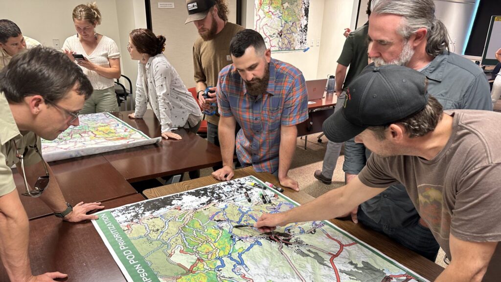
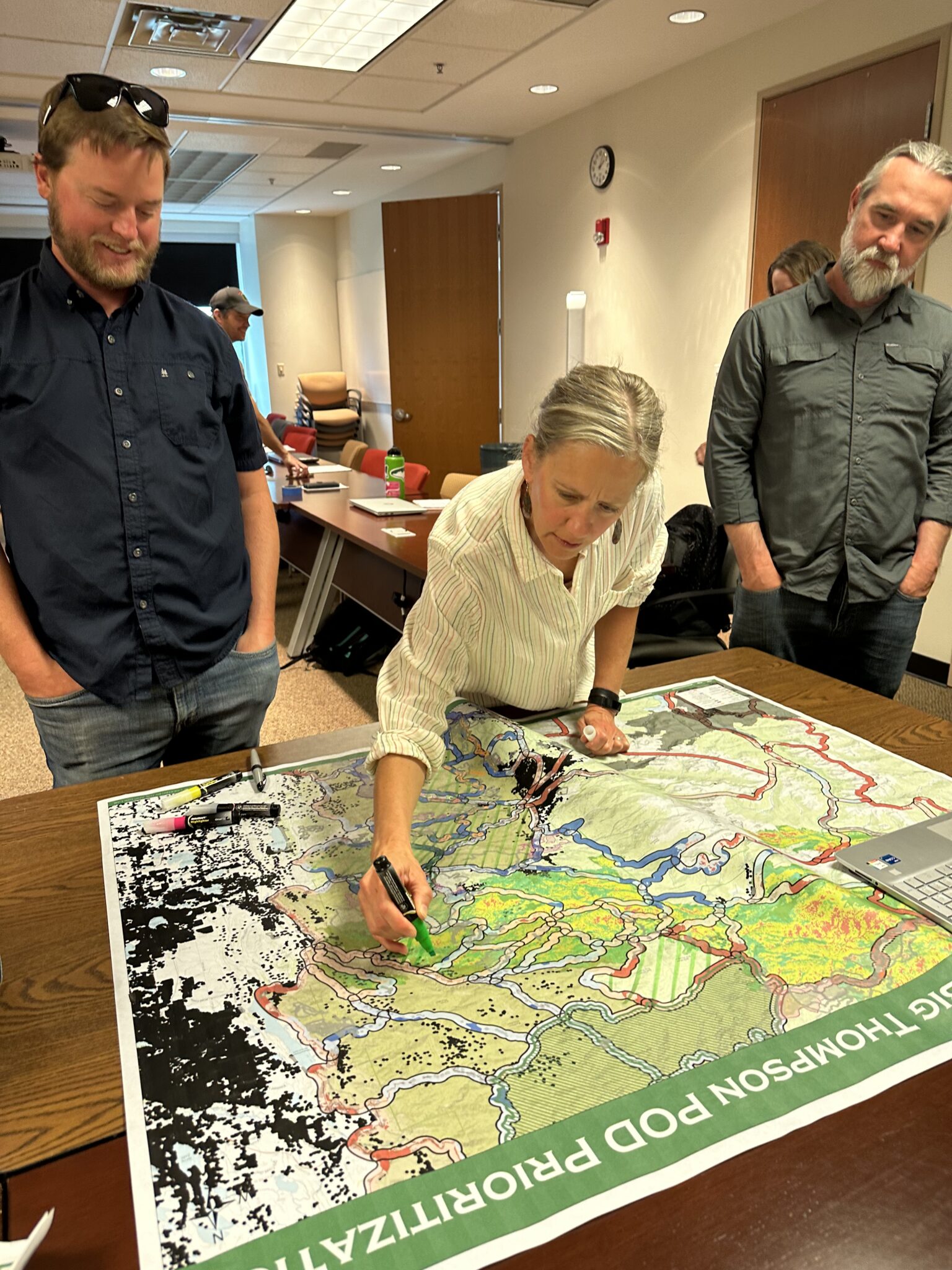
Last week, members of the Big Thompson Watershed Health Partnership came together for a crucial initiative—to map out PODs (Potential Operational Delineations) across the watershed. Led by Daniel Godwin, Fire Management Planning Specialist and Wildfire Crisis Strategy Program Manager for the Arapahoe-Roosevelt National Forest, this mapping exercise aimed to identify and connect PODs within our watershed and neighboring areas. These PODs act as a “fire seawall,” serving as our first line of defense against future fires and providing an essential planning tool.
Understanding PODs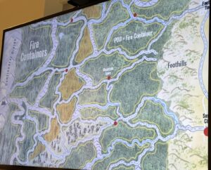
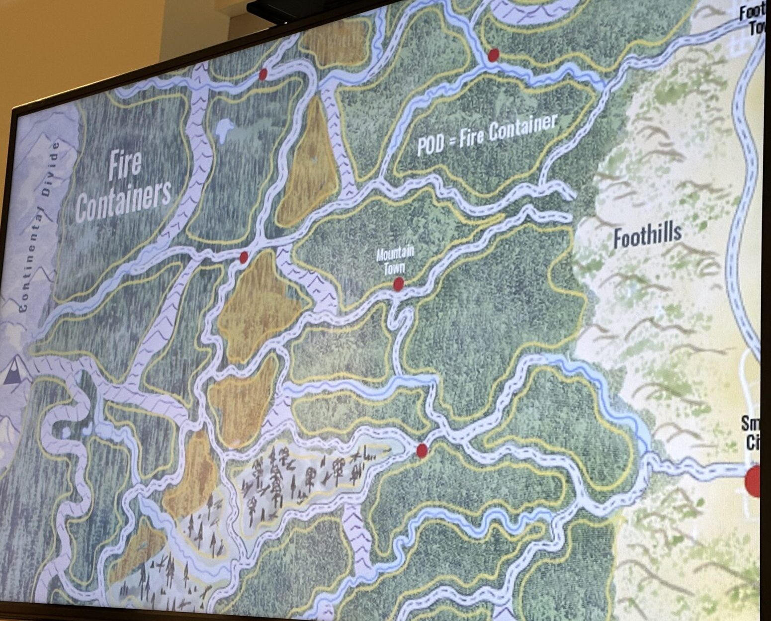
PODs are spatial units or containers defined by potential control features, such as roads, streams, and ridge tops. They serve as areas where relevant information on forest conditions, ecology, and fire potential can be summarized. The goal is for local, state, and federal partners to collaboratively identify and document these features before smoke fills the air. By combining local fire knowledge with advanced spatial analytics, PODs help managers develop a common understanding of risks, management opportunities, and desired outcomes, leading to effective fire management objectives.
 The Mapping Process
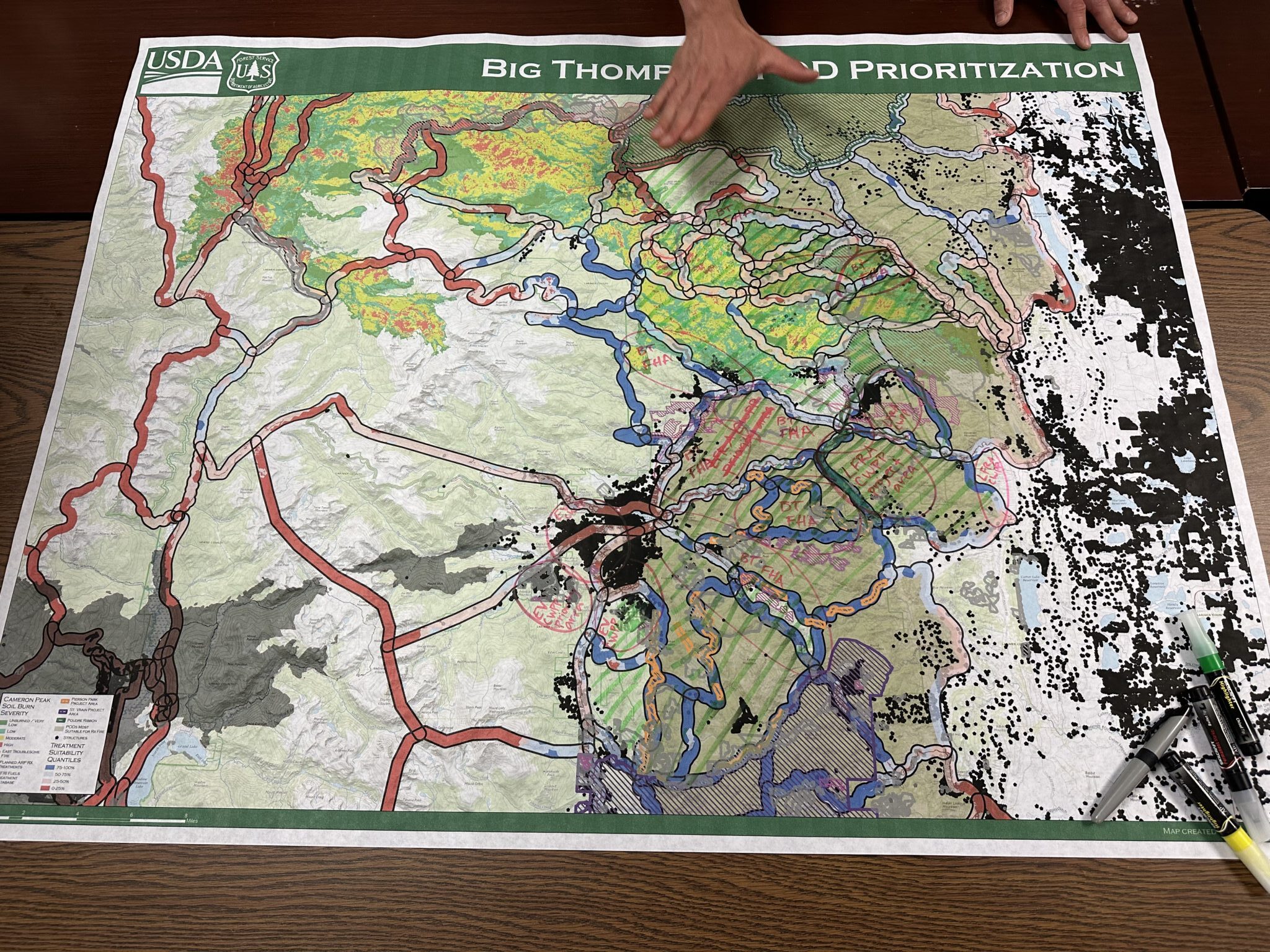
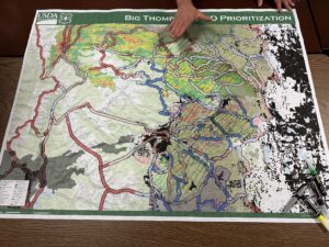
The mapping of PODs begins with the utilization of analytical products developed and maintained by the U.S. Forest Service Rocky Mountain Research Station (RMRS). Partners then utilize their firsthand local knowledge of the watershed to fine-tune the optimal locations for PODs across the landscape. While analytical tools are essential for effective fire management strategies, it is the individuals working on the ground who possess the unparalleled knowledge of the area. Hence, the collaboration between local collaborators, like the Big Thompson Watershed Health Partnership, and adjacent landowners and jurisdictions is crucial in providing valuable insight for cross-boundary planning.
Expanding Fire Preparedness
Moving forward, the next steps in this important work involve mapping current wildfire mitigation projects within the watershed. This step aims to further expand our understanding of the remaining risks and determine the best strategies to address them. By incorporating these additional risk areas into our fire preparedness efforts, we can enhance our ability to mitigate potential fire incidents effectively.
The mapping of PODs in the Big Thompson Watershed represents a significant milestone in our ongoing efforts to enhance fire preparedness. Through collaborative work and the integration of local knowledge with advanced analytical tools, we are creating a comprehensive framework to effectively manage wildfires and protect our communities. By continuing to expand our understanding and address potential risks, we are taking proactive measures to safeguard the watershed and its surrounding areas from the devastating impact of future fires. Together, we are building a stronger, more resilient community.