Autumn Wildfires: A Curse and a Blessing
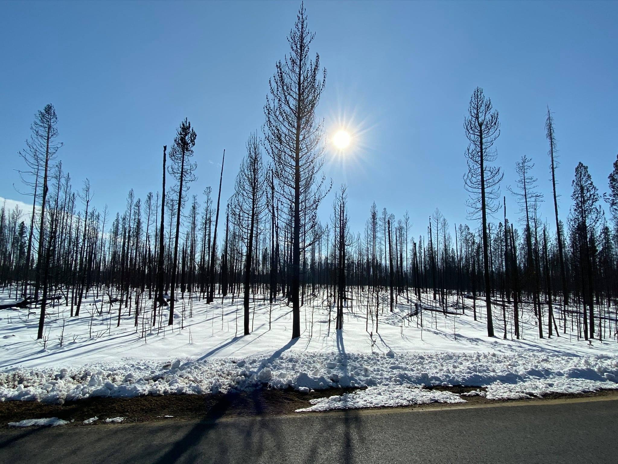
The Cameron Peak and East Troublesome wildfires impacted more than 400,000 acres and encompassed over 625 square miles in the autumn of 2020. The timing of those fires were both a curse and a blessing.
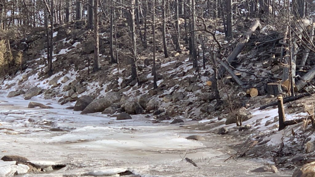
Late season wildfires such as these feed off of drier and more abundant fuel loads than would normally be seen in late spring and early summer. Increased fuel loads can lead to larger, more severe wildfires. On the flip side, fall burn scars are not exposed to the impacts of intense summer rain events which can send an abundance of fresh ash, sediment and debris onto roads and into vulnerable water supplies, as was the case after the High Park Fire in June 2012. Another benefit, if one can call it that, of a fall wildfire is that it provides natural resource experts, municipalities and water providers with a healthy window of time to plan and initiate restoration projects upstream to reduce the impacts downstream once spring rains begin four to six months later.
A Unique Opportunity
The 2020 NOCO fires provide a unique opportunity to study the effects of late season, high elevation fire on snowpack and water supplies. Fortunately, a team of scientists at CSU recognized this opportunity and were awarded a $50,000 grant from the National Science Foundation to study snowpack, streams and sediment in waterways in the areas affected by the Cameron Peak Fire.
Stephanie Kampf, principal investigator and a professor in the Department of Ecosystem Science and Sustainability, explained previous research on the impacts of wildfires on snowpack have been quite variable. “When there’s a fire, we can see increased snow accumulation, due to fewer trees intercepting the snow,” she said. “But this doesn’t always happen. Sometimes greater exposure of the snow to the sun leads to lower snowpack after fire.” She went on to say, “while snow melt doesn’t usually create high elevation snow hazards, it’s possible that having greater snowpack in the burn area may cause other hazards like debris flows.”
Risk Assessments: Painting a Picture of What’s to Come
In addition to the current CSU study, Larimer County and the U.S. Forest Service have conducted risk assessments ahead of spring weather events to get a better understanding of potential impacts and necessary mitigation actions. Upon completion of the BAER (Burned Area Emergency Response) assessments the USFS reported, “these assessments represent a small part of the greater, collaborative, post-wildfire recovery efforts currently underway with a coalition of local, state and federal agencies, scientists and natural resource managers.” One of the most valuable tools BAER assessments produce is soil burn severity maps, these maps provide valuable data as recovery teams model potential affects and make post fire recovery decisions. Since the Cameron Peak and East Troublesome fires’ lasted late in the season, BAER team’s efforts were hampered by snow and hazardous conditions requiring teams to return to certain areas in the spring for further assessment.
Larimer County expanded upon the BAER Report by conducting its own Risk Assessment of the Cameron Peak Fire burn area to determine levels of risk for communities and to determine possible actions to minimize post-fire flood impacts.
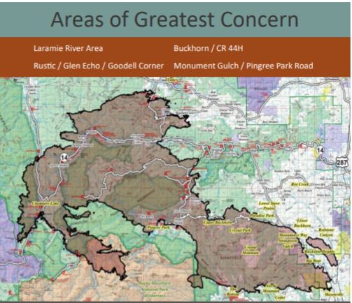
The areas of concern the county focused on in their assessment were burn severity by neighborhood, potential for debris flow by neighborhood, public and private road infrastructure and FEMA Floodplain locations at risk from flooding and debris flows. Examination of neighborhoods by debris flow potential resulted in the identification of 8 neighborhoods that have potential to experience significant debris flows.
These neighborhoods include: Big Bear, Crystal Mountain, Goodell Corner, Monument Gulch, Red Feather Lakes, Redstone Canyon, Storm Mountain, and Upper Buckhorn.
The Race Against the Clock
The $100 million question, which also happens to be the anticipated recovery costs for the Cameron Peak and East Troublesome wildfires, is if impacts to downstream water supplies will occur after heavy spring snowstorms or from rain later this spring and early summer. Experts believe the three affected watersheds (Poudre, Big Thompson and Laramie) will incur the most damage over the first 10 precipitation events.
It is literally a race against the clock, by dozens of organizations from both the private and public sector, to stabilize hillslopes, remove debris and protect critical water supplies. Fortunately, the High Park fire provided an excellent learning opportunity. Jill Oropeza, Water Quality Services Manager for the City of Fort Collins recently told KUNC, “I think we’re better prepared from a treatment standpoint, understanding what we can and can’t do.” And after all the hardships 2020 presented we’ll take any good new we can.